Yulin Han_PakistanYulin Han_Pakistan
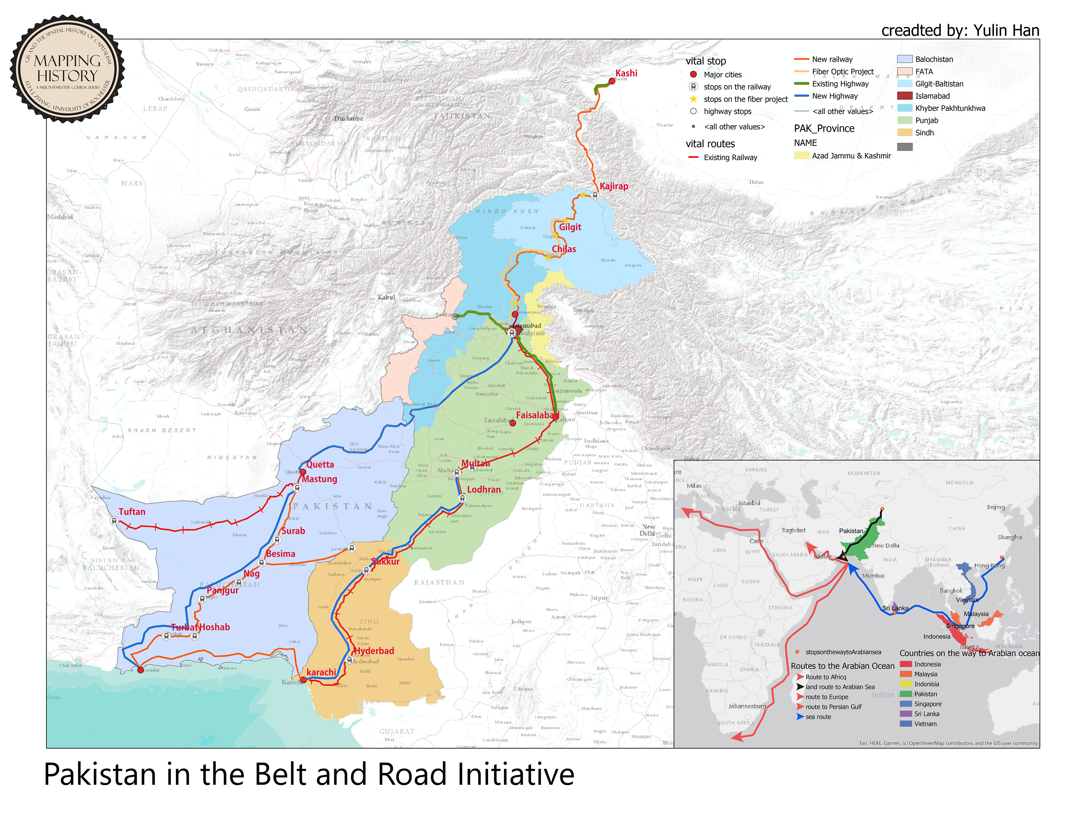
The entire map is combined by two parts: a main map of Pakistan indicating the GDP per capita ranking of different provinces and infrastructure projects of the China-Pakistan economic corridor, and an attached map indicating the geographical importance of access of Pakistan, especially the Gwadar port. In the main map different provinces of Pakistan has been put in different colors, ranking according to the order of the rainbow the average GDP per capita decreases accordingly. Different lines with different symbology and color in the map are aiming to show the projects (including railway, highway, and optic fiber project) that China are investing for either update or construction. The small map shows the contrast of the access to the Arabian sea through the land route and the sea route.
