Course Description:
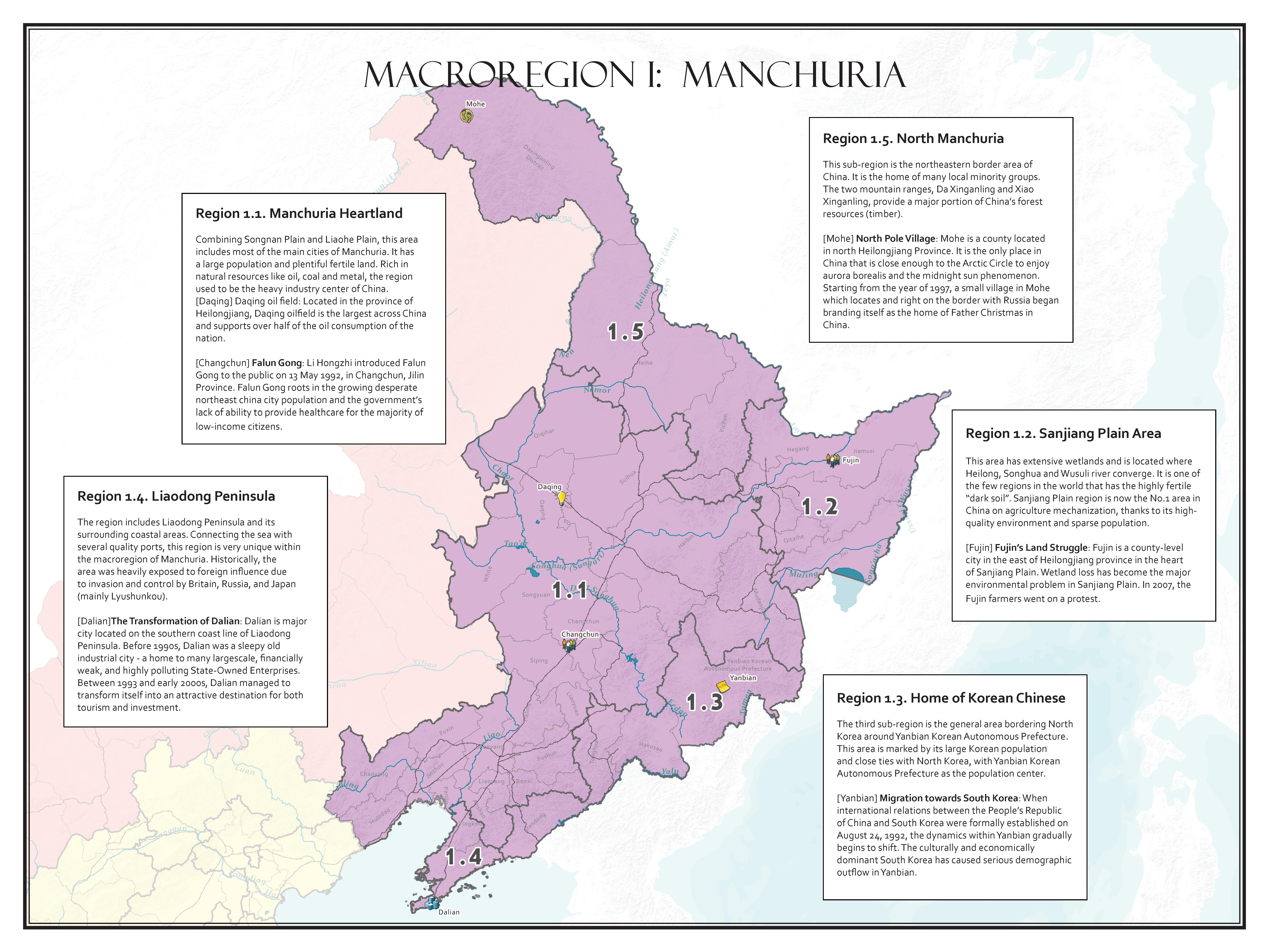
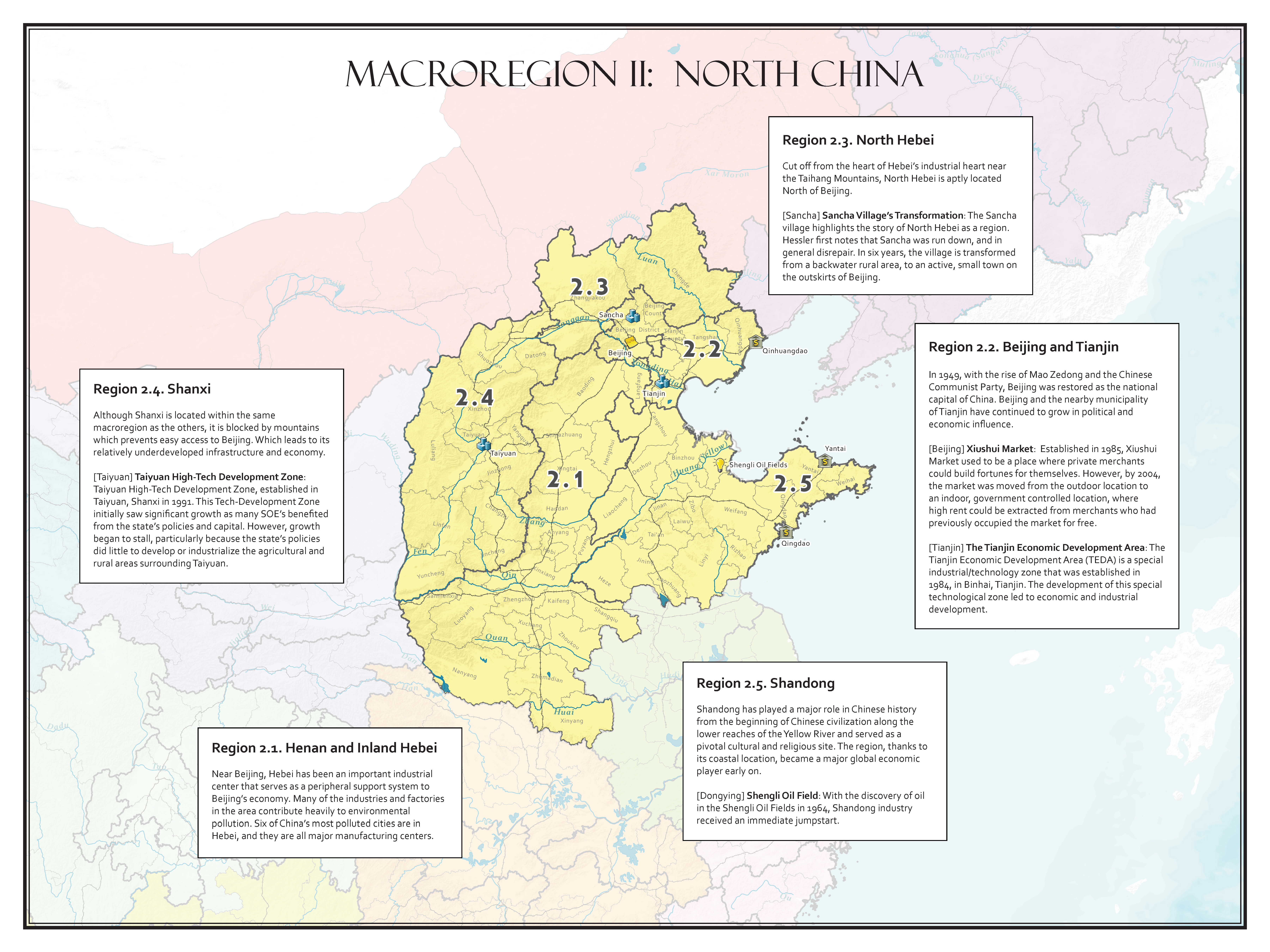
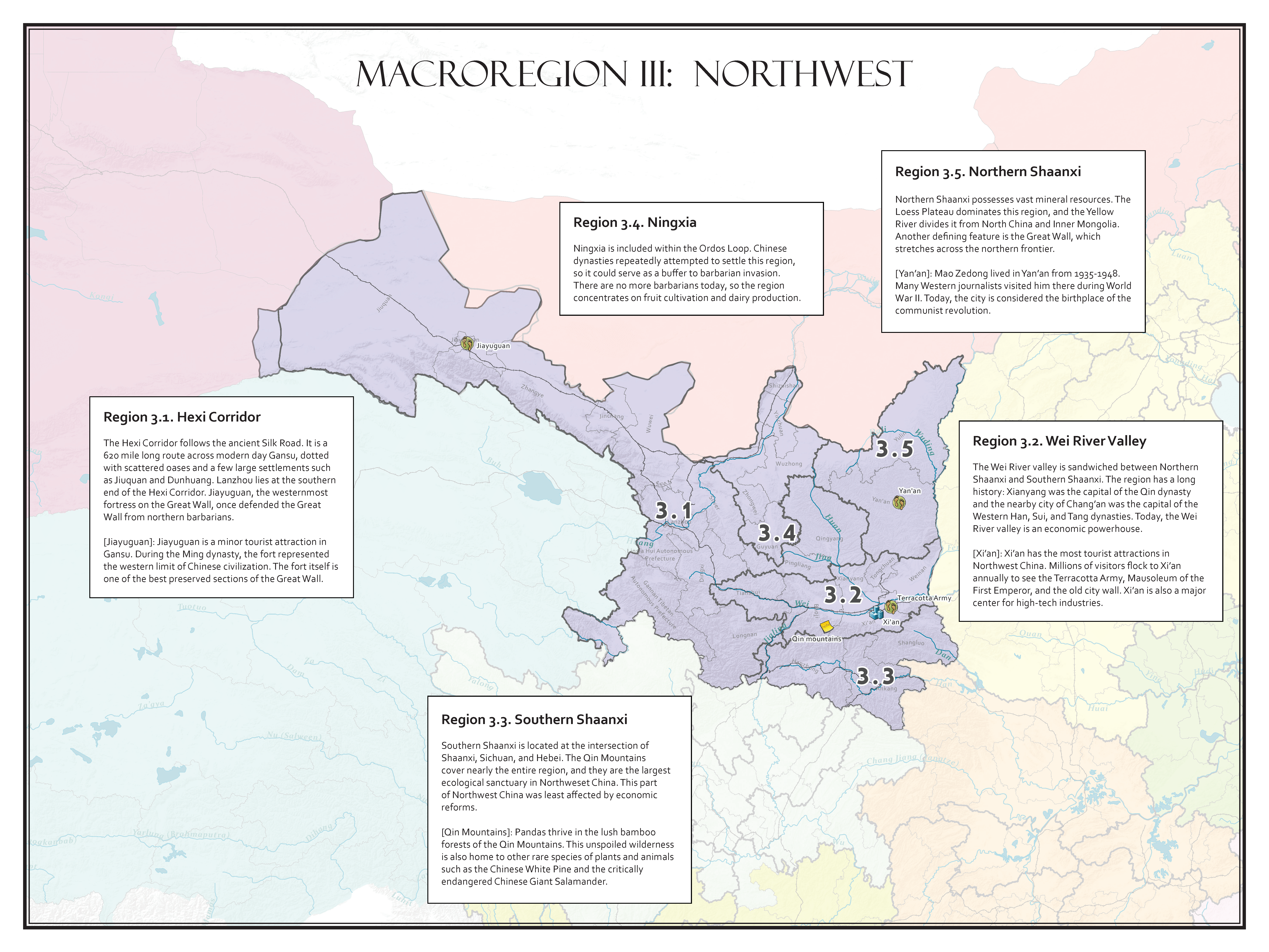
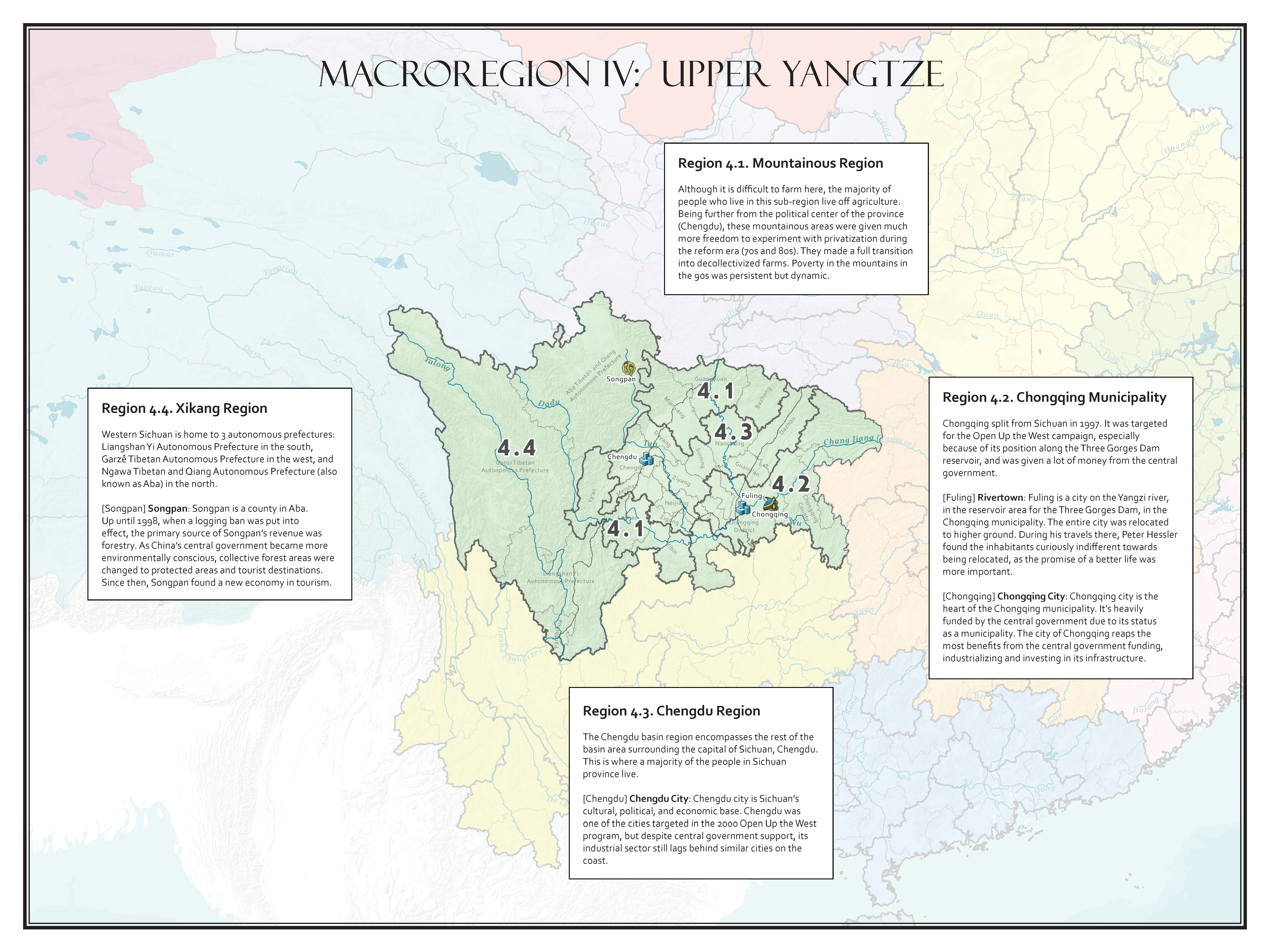
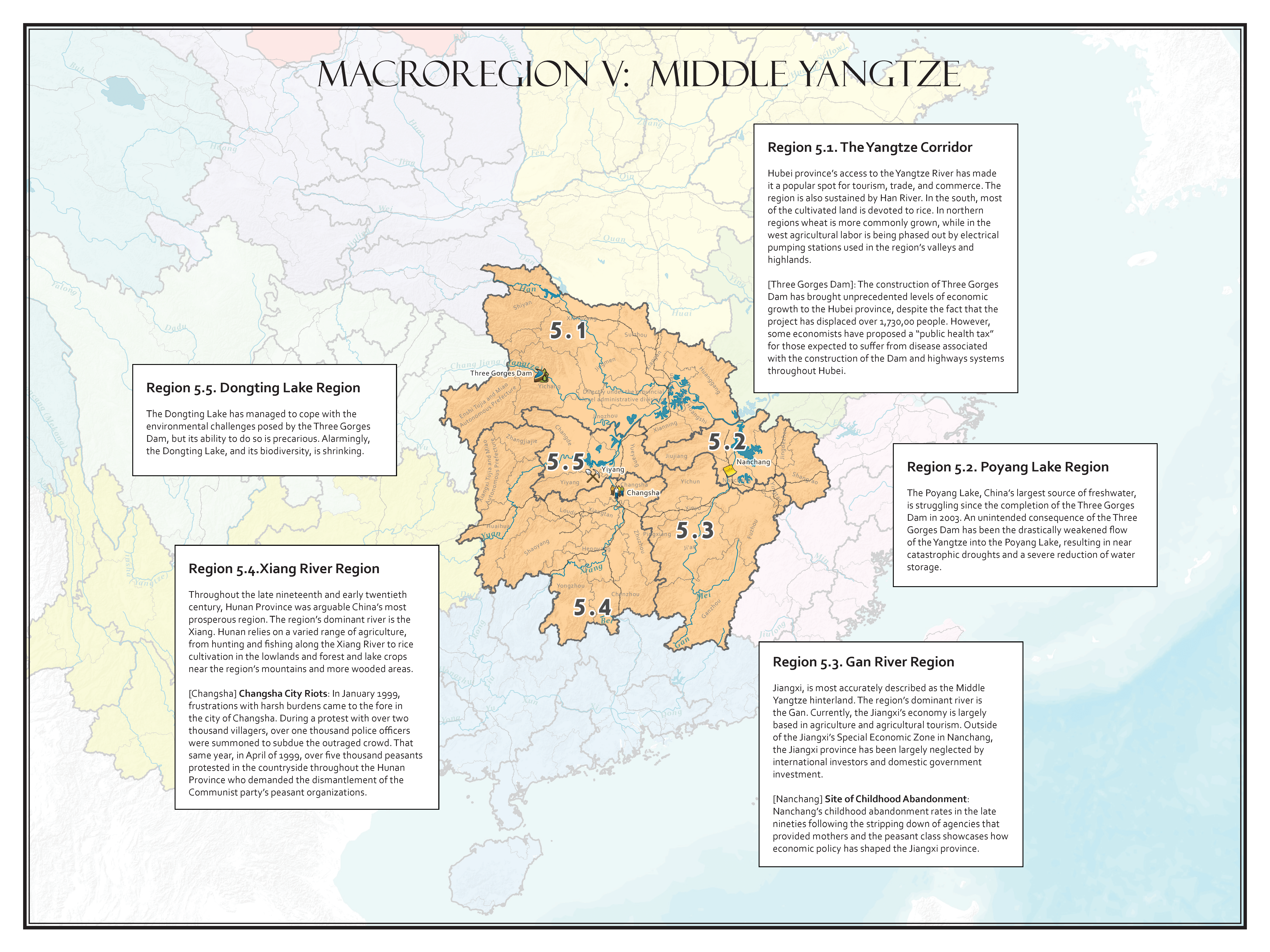
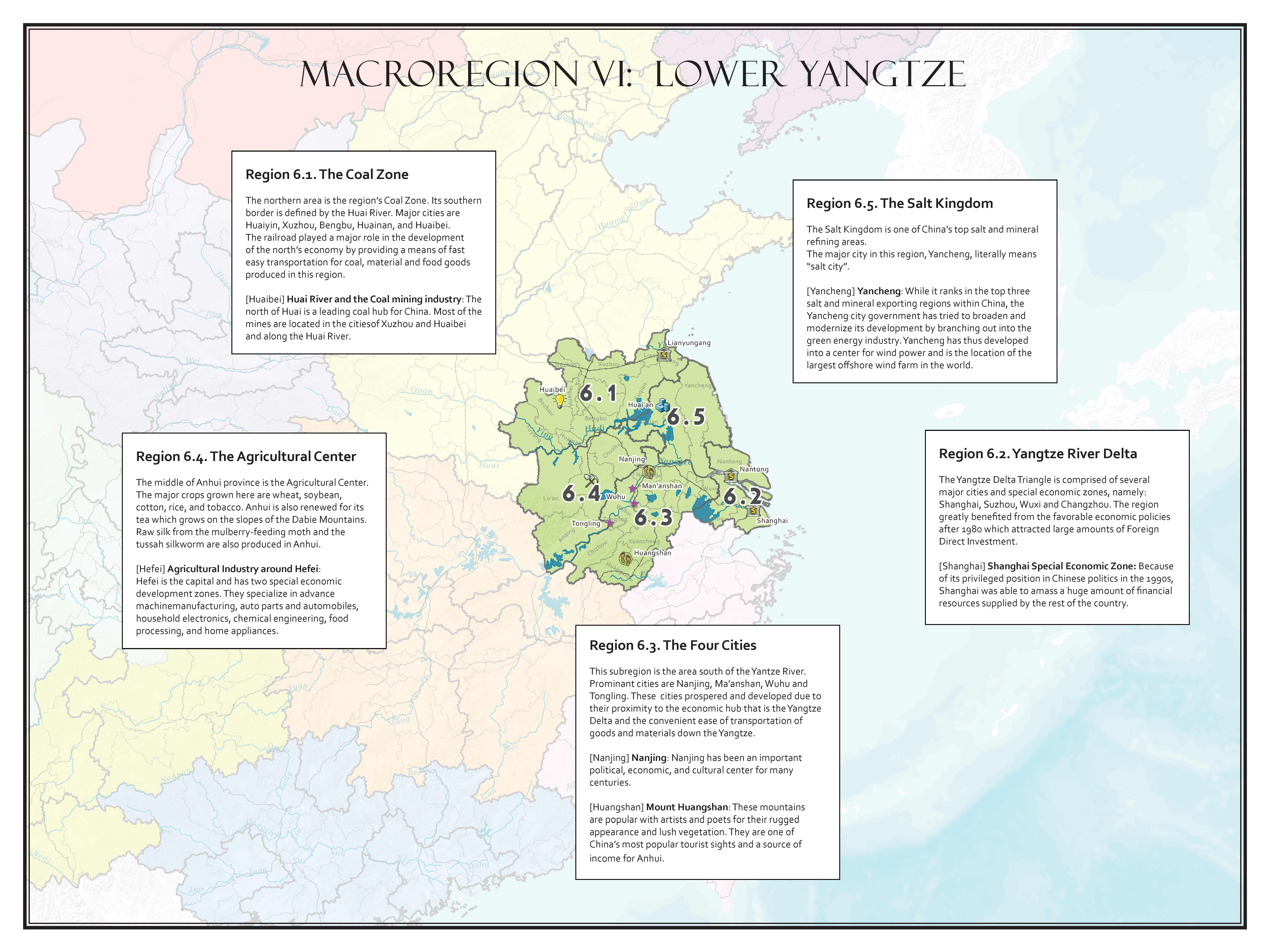
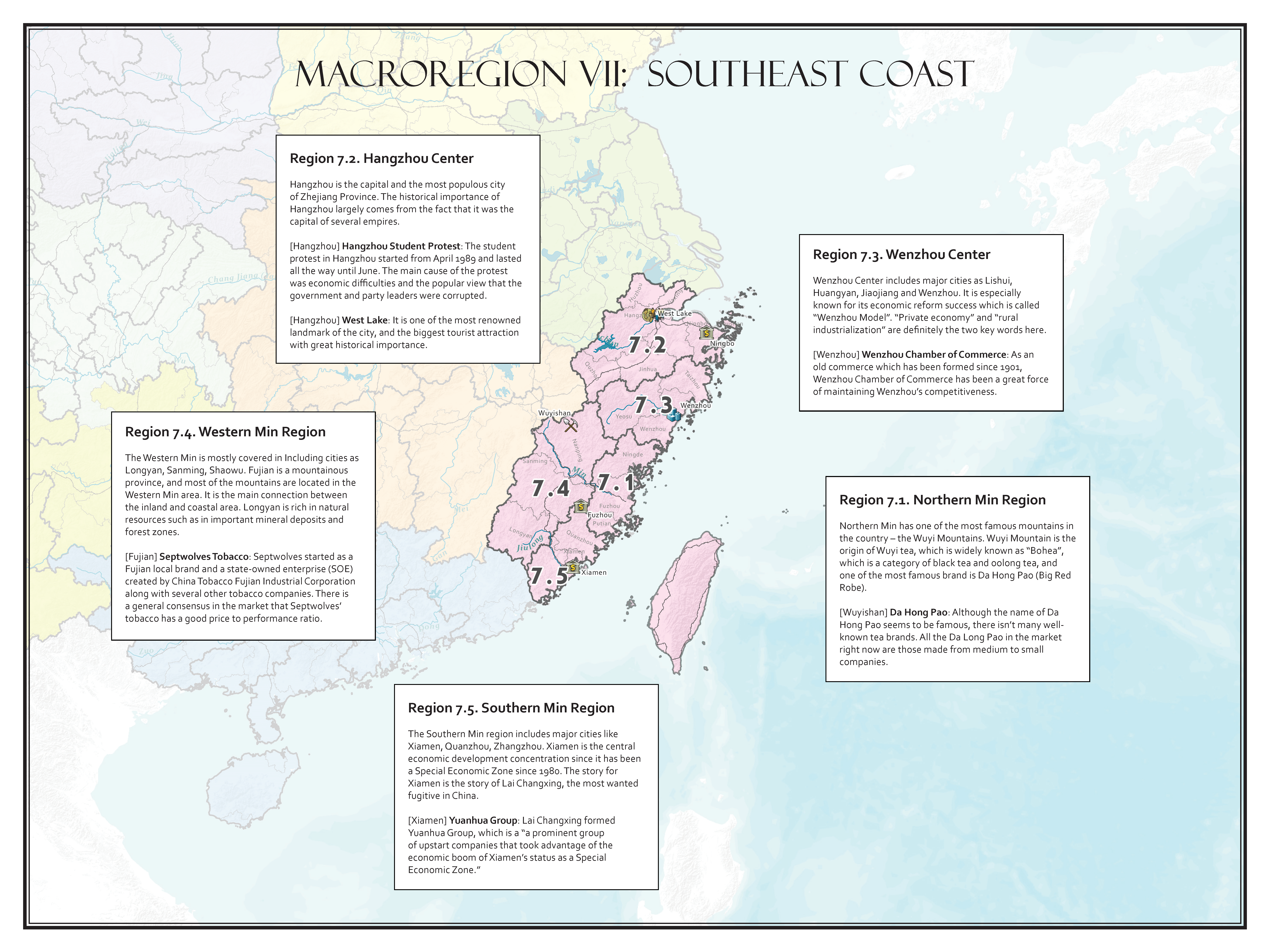
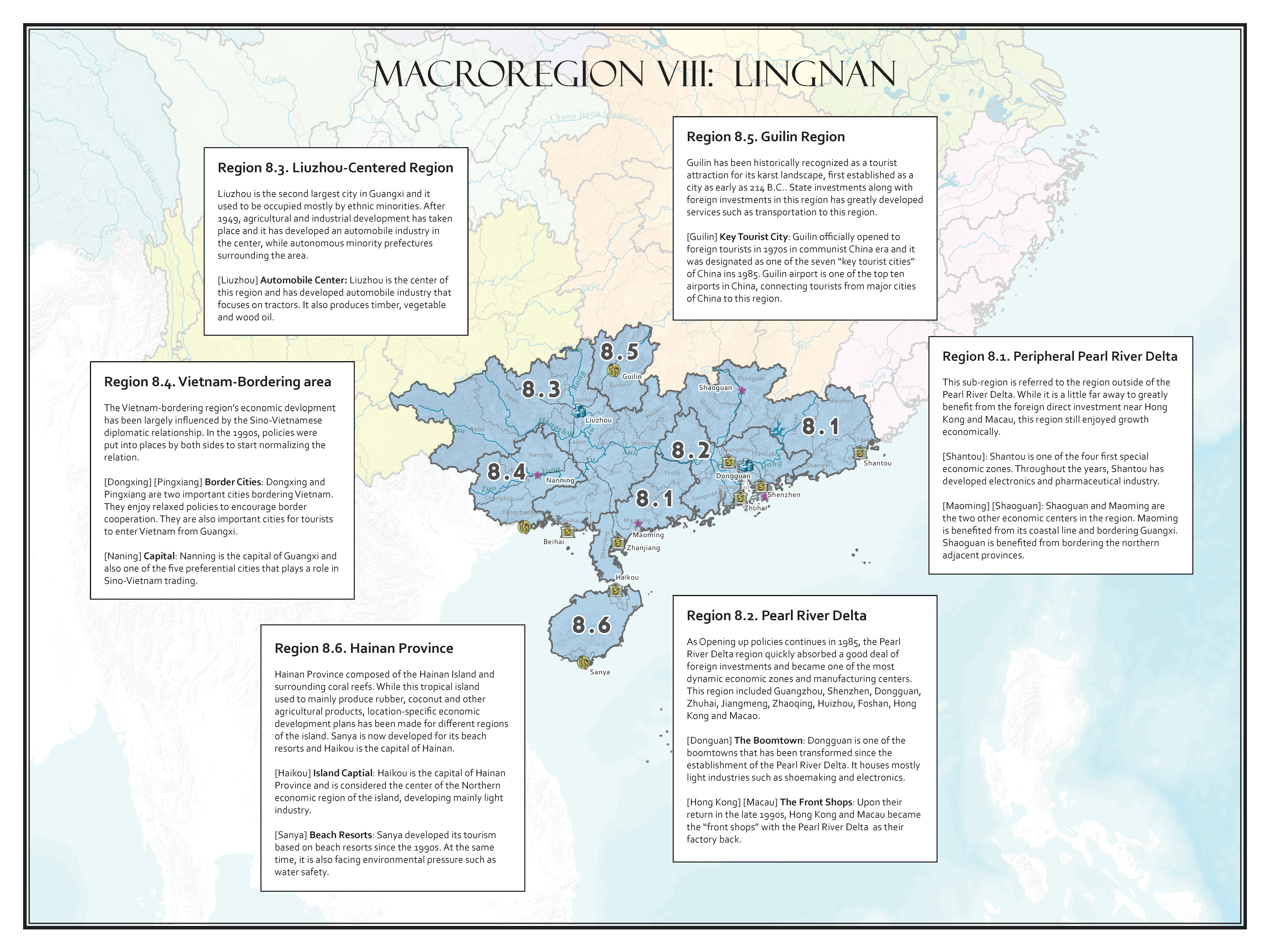
In this class we set out to find out how China transformed itself from a socialist country to a capitalist giant, and furthermore, how its twelve macro regions fared differently in this economic “miracle.” The twelve regions are: Manchuria, North China, Lower-Yangtze, Middle Yangtze, Southeast Coast, Lingnan, Yungui, Upper-Yangtze, Northwest, Tibet-Qinghai, Xinjiang, and Inner Mongolia.
Assignments:
Each of the twelve students in the class was in charge of telling the story of one macro region through two assignments. In the first assignment, they collaborated on a Netline map, identified eighty-seven economic events, situated them on the map and also tied them together through a common digital timeline.
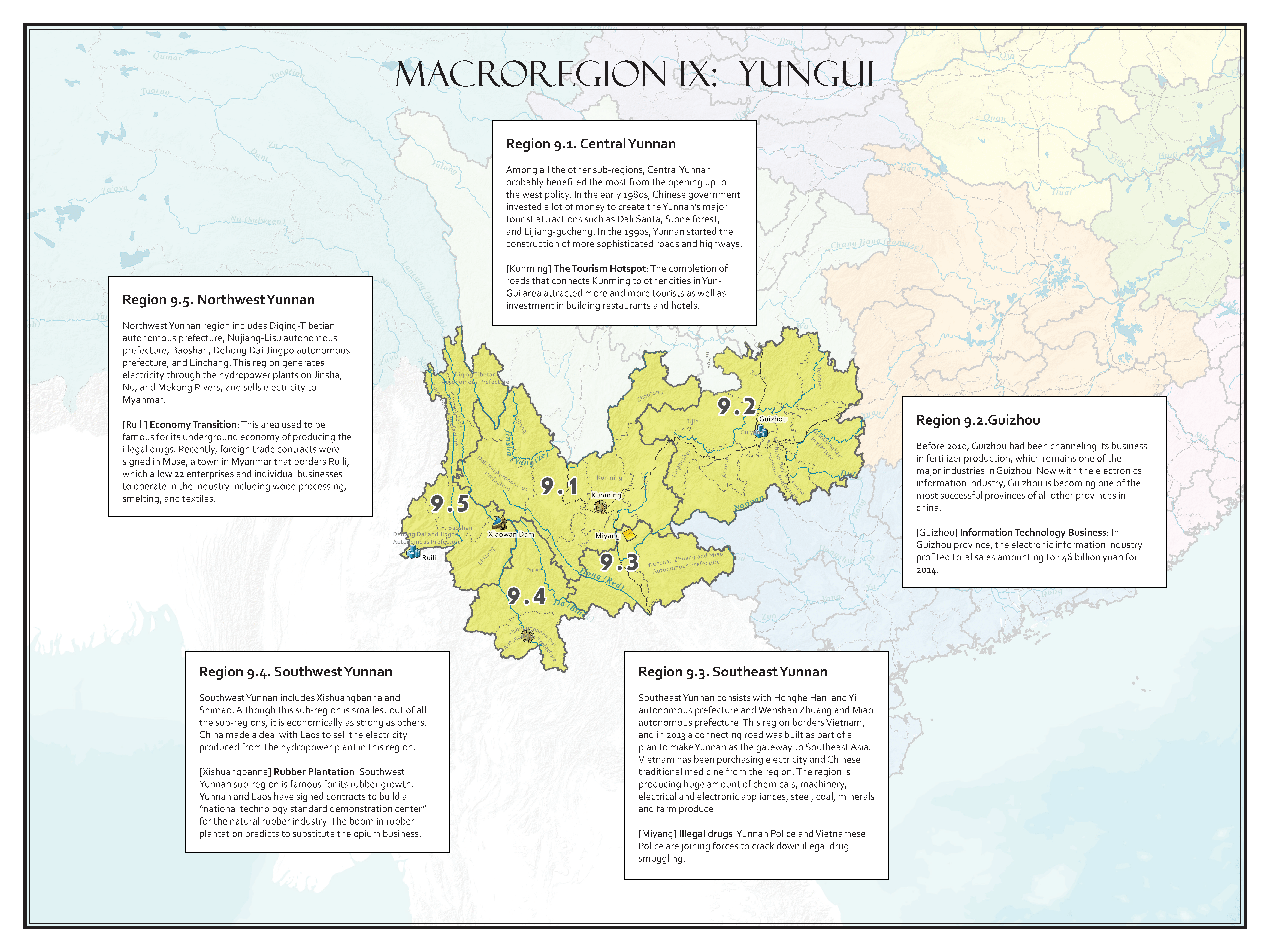
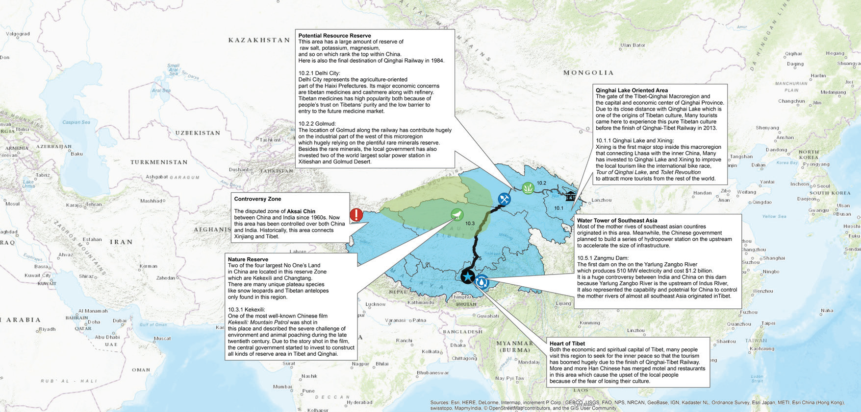
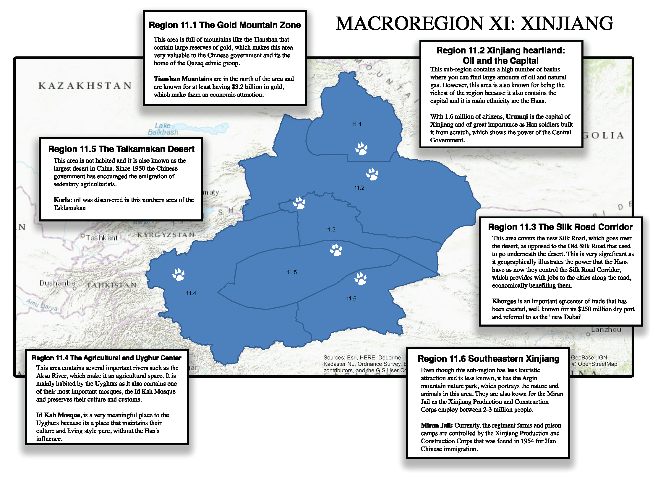
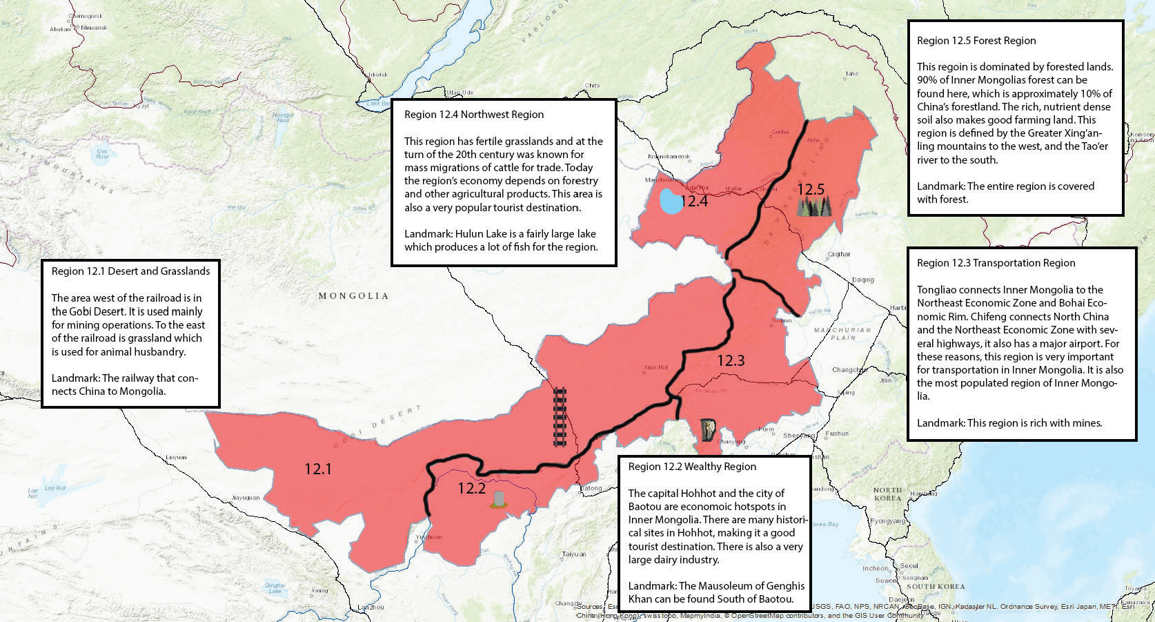
In the second assignment, each student divided his/her macro regions into four to five sub-regions, describe the unique characteristics (physical, cultural, or economic) of each region, and discuss how these regions fared differently from each other in the past thirty years of economic “miracle.” Their research findings were demonstrated on twelve separate ArcGIS maps.
